Golf Leaf service included on Rocky Mountaineer
Pre cruise and train Transfers
Hotel Stays in Banff, Kamloops and Vancouver
Luxury Cruise onboard Seabourn for 14 nights.


Price from $14,839 pp
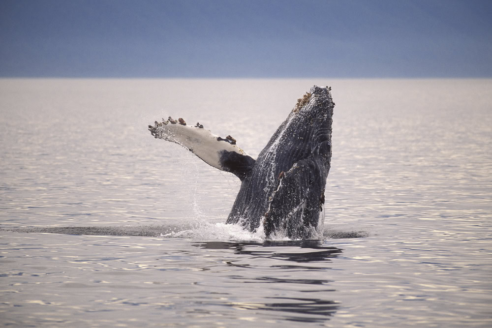
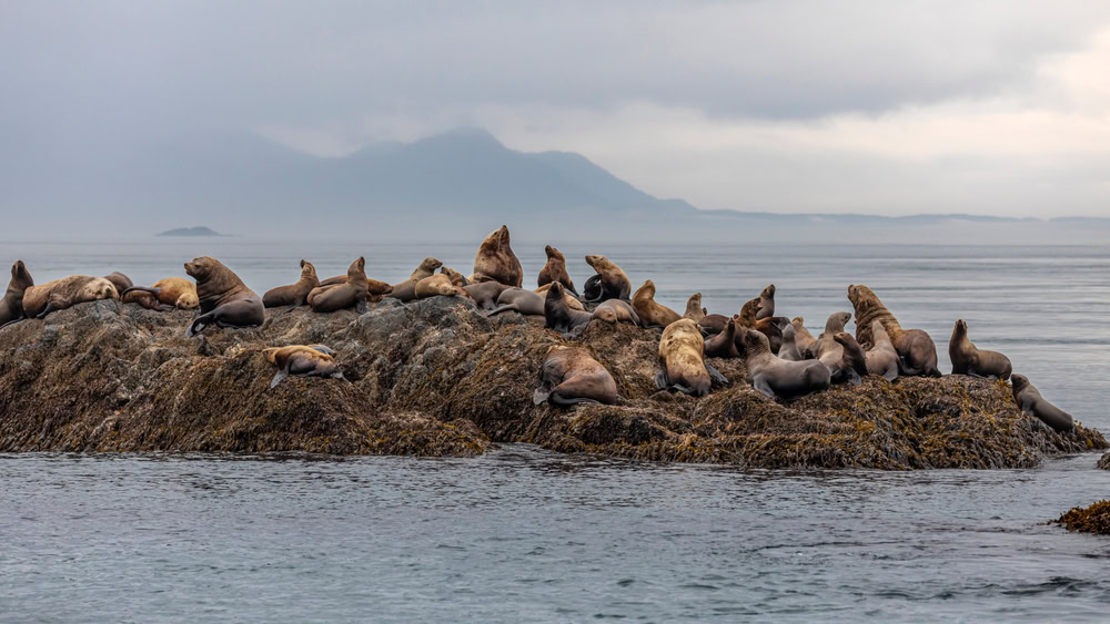
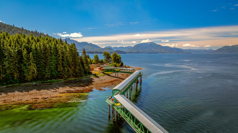
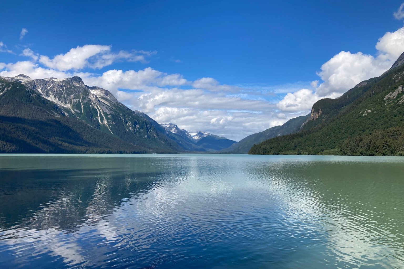
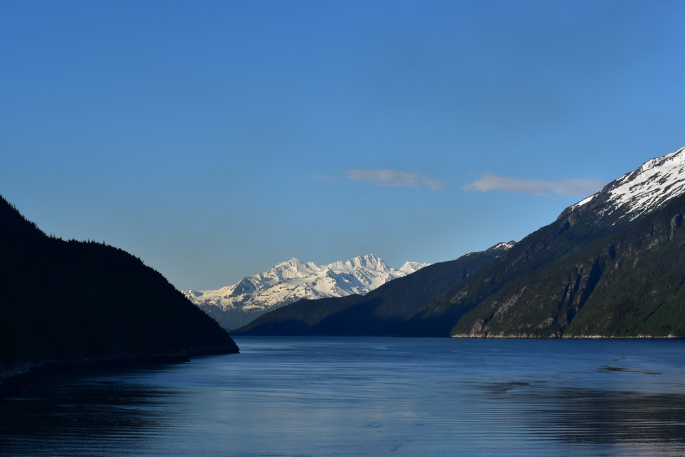
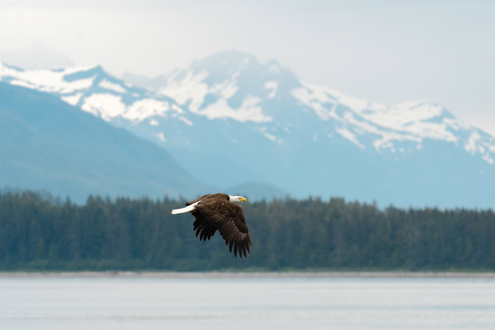
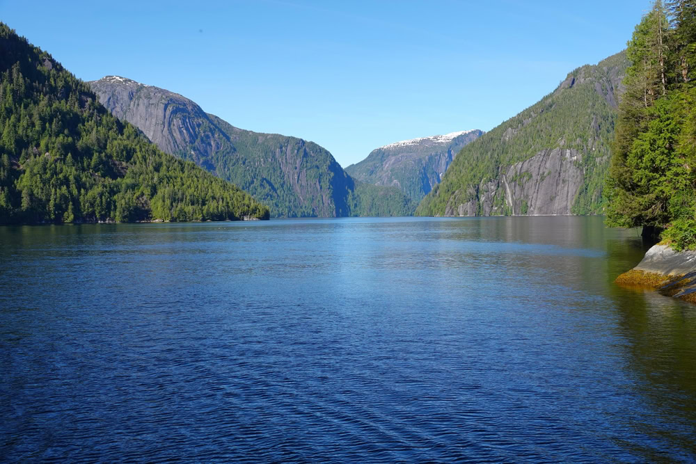
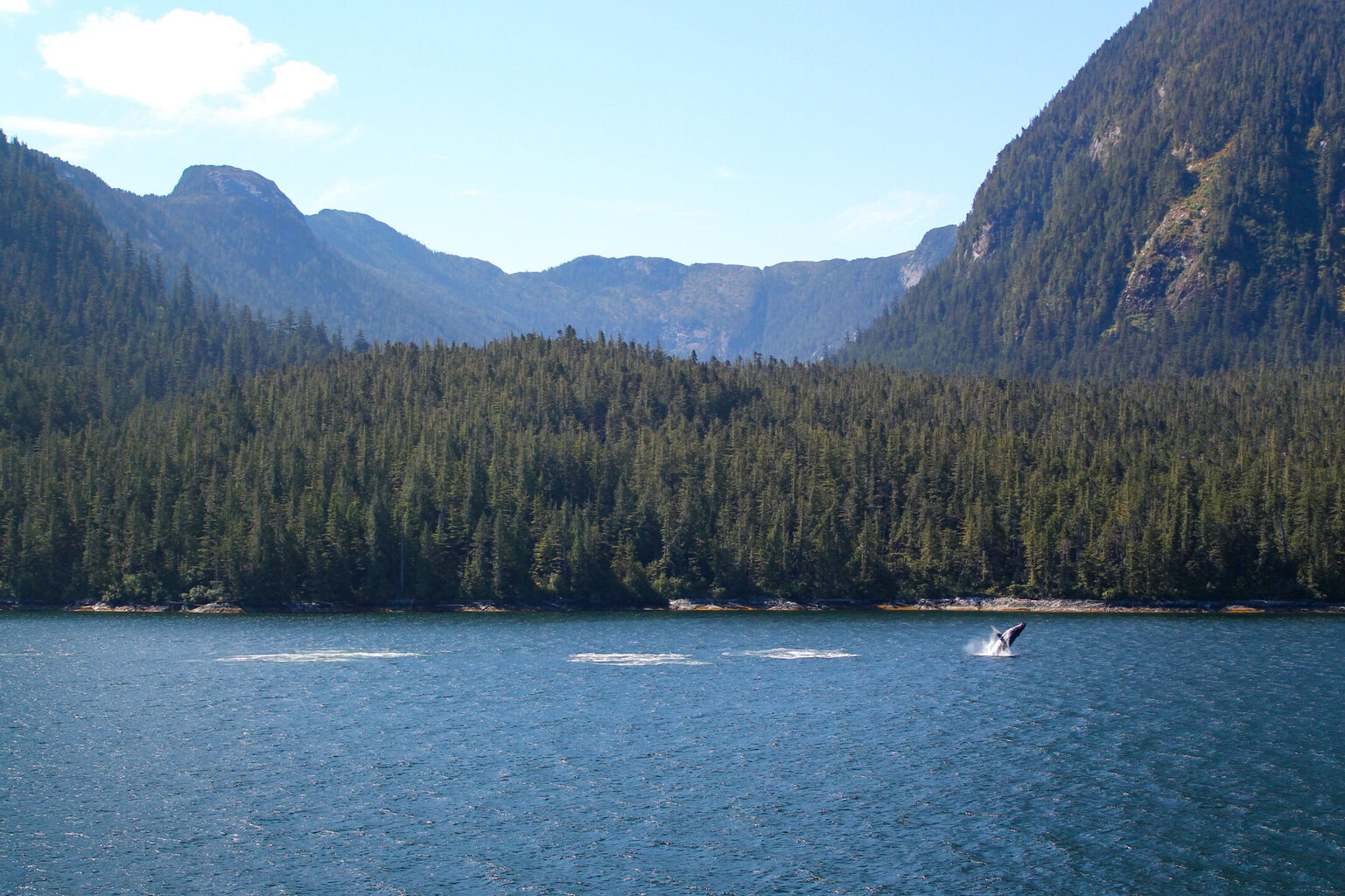
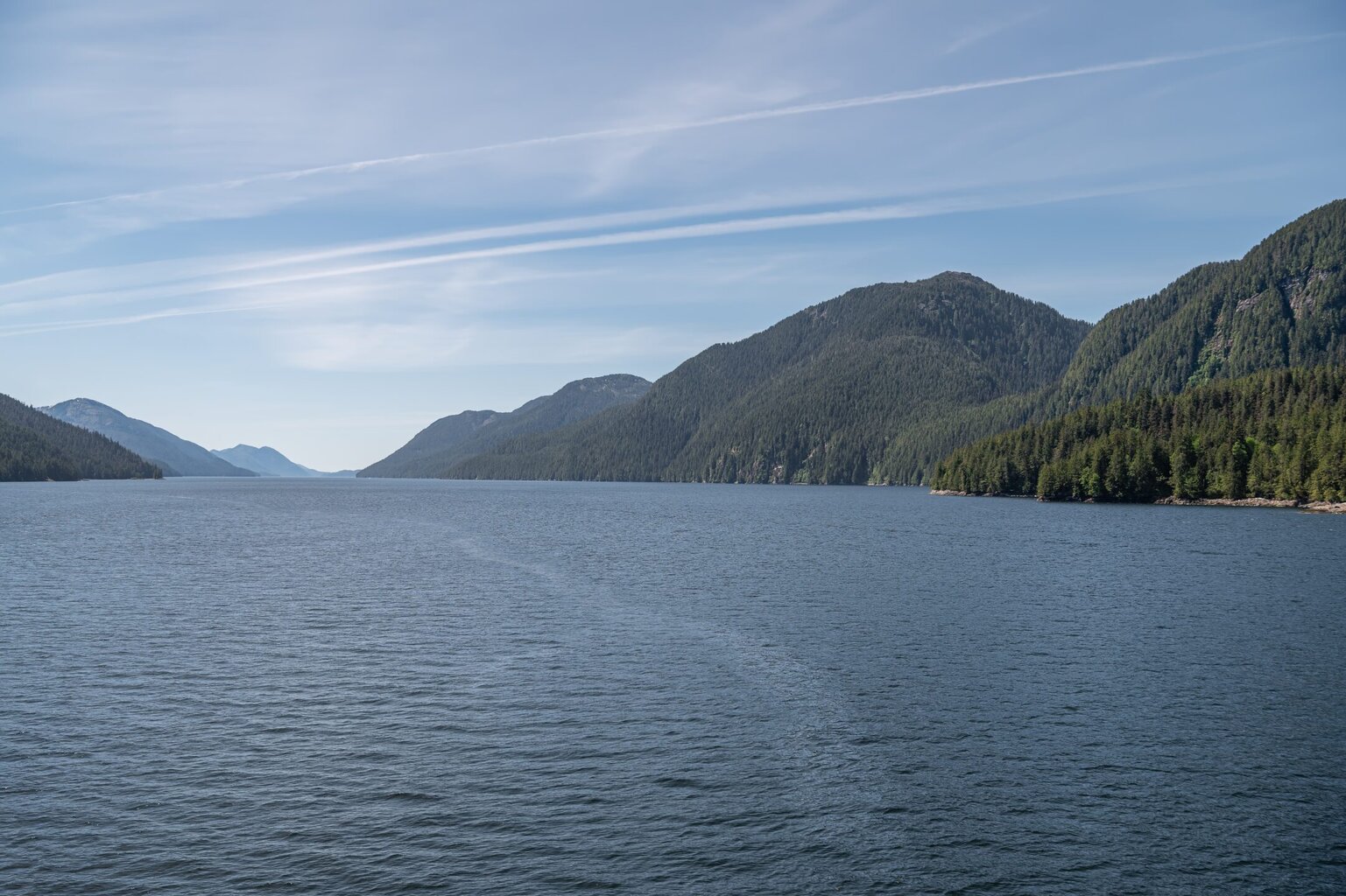
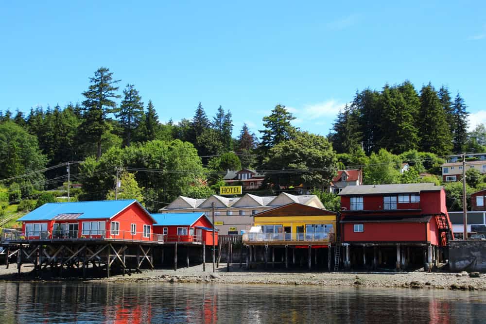
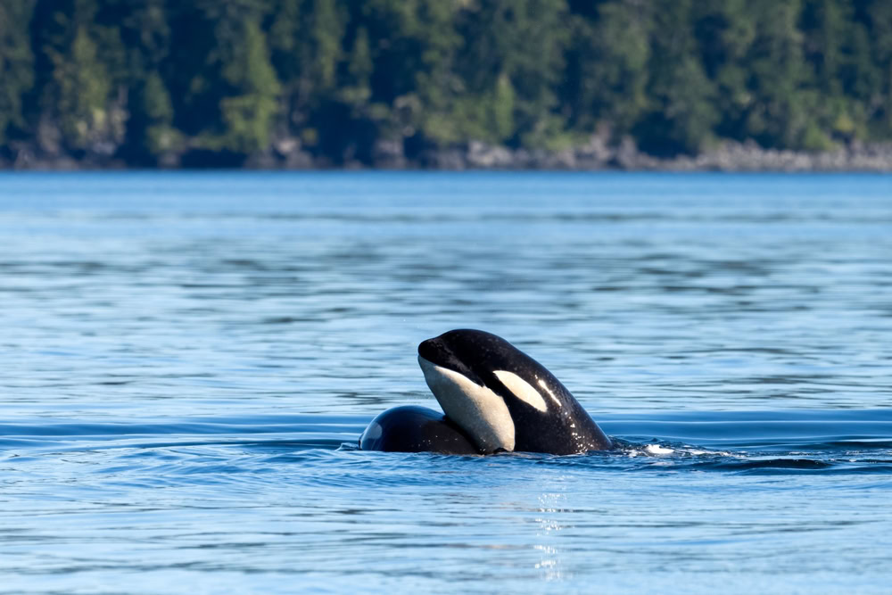
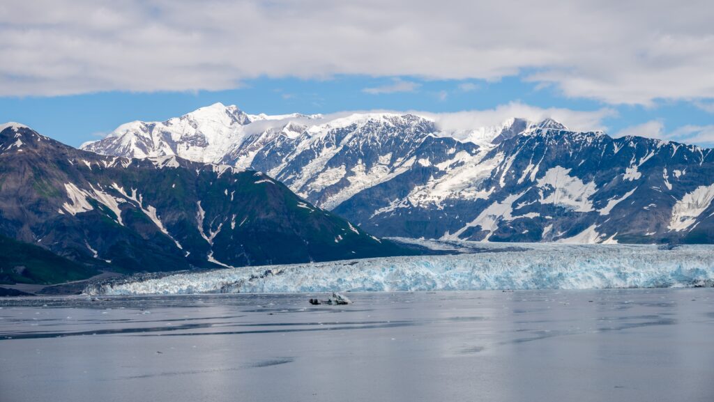
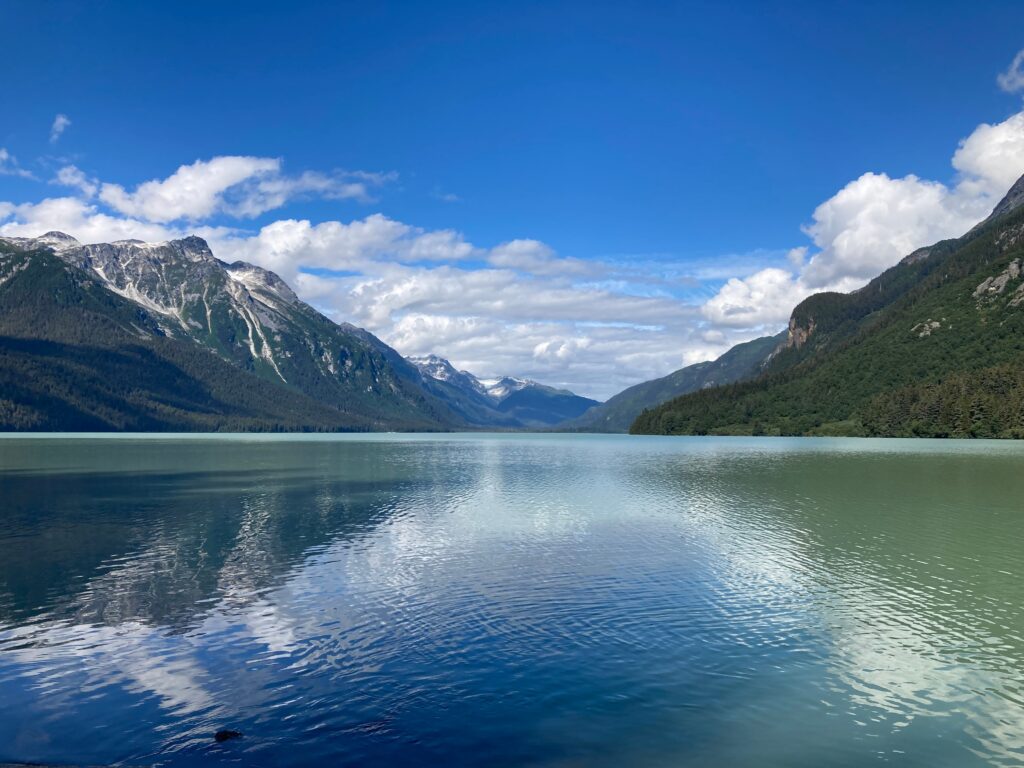
Banff - Banff - Kamloops - Vancouver - Vancouver, B.C., CA - Transit the Seymour Narrows - Cruising the Queen Charlotte Sound - Ketchikan, Alaska, US - Transit Snow Pass - Transit Decision Passage - Sitka, Alaska, US - Cruising Yakutat Bay - Hubbard Glacier (Scenic Cruising) - Inian Islands, Alaska - Icy Strait Point, Alaska, US - Haines, Alaska, US - Cruising Lynn Canal - Juneau, Alaska, US - Tracy Arm - Cruising Stephens Passage - Transit Decision Passage - Wrangell, Alaska, US - Cruising Stikine Strait - Cruising Behm Canal - Rudyerd Bay (Misty Fjords), AK, United States - Scenic cruising Misty Fjords - Prince Rupert, British Columbia, Canada - Scenic cruising Grenville Channel - Scenic Cruising Whale Channel - Scenic cruising Princess Royal Channel - Alert Bay, British Columbia, Canada - Scenic cruising Johnstone Strait - Transit the Seymour Narrows - Vancouver, B.C., CA
0
15th Jun ‘25
Arrive
Depart
1
15th Jun ‘25
Arrive
Depart
2
15th Jun ‘25

Arrive
Depart
3
15th Jun ‘25

Arrive
Depart
4
Arrive
Depart
5
15th Jun ‘25

Arrive
Depart
6
15th Jun ‘25
Arrive
Depart
7
15th Jun ‘25

Arrive
Depart
8
15th Jun ‘25
Arrive
Depart
9
15th Jun ‘25

Arrive
Depart
10
15th Jun ‘25

Arrive
Depart
11
15th Jun ‘25
Arrive
Depart
12
15th Jun ‘25

Arrive
Depart
13
15th Jun ‘25
Arrive
Depart
14
15th Jun ‘25
Arrive
Depart
15
15th Jun ‘25
Arrive
Depart
16
15th Jun ‘25
Arrive
Depart
17
15th Jun ‘25

Arrive
Depart
18
15th Jun ‘25

Arrive
Depart
19
15th Jun ‘25
Arrive
Depart
20
15th Jun ‘25
Arrive
Depart
21
15th Jun ‘25
Arrive
Depart
22
15th Jun ‘25
Arrive
Depart
23
15th Jun ‘25
Arrive
Depart
24
15th Jun ‘25

Arrive
Depart
25
15th Jun ‘25
Arrive
Depart
26
15th Jun ‘25
Arrive
Depart
27
15th Jun ‘25
Arrive
Depart
28
15th Jun ‘25

Arrive
Depart
29
15th Jun ‘25

Arrive
Depart
30
15th Jun ‘25
Arrive
Depart
31
15th Jun ‘25
Arrive
Depart
32
15th Jun ‘25
Arrive
Depart
33
Arrive
Depart
1
19th Aug ‘25
Arrive
Depart
2
20th Aug ‘25
Arrive
Depart
3
20th Aug ‘25
Arrive
Depart
4
21st Aug ‘25
Arrive
Depart
5
22nd Aug ‘25
Arrive
Depart
6
22nd Aug ‘25
Arrive
Depart
7
23rd Aug ‘25
Arrive
Depart
8
24th Aug ‘25
Arrive
Depart
9
24th Aug ‘25
Arrive
Depart
10
24th Aug ‘25
Arrive
Depart
11
25th Aug ‘25
Arrive
Depart
12
26th Aug ‘25
Arrive
Depart
13
26th Aug ‘25
Arrive
Depart
14
27th Aug ‘25
Arrive
Depart
15
27th Aug ‘25
Arrive
Depart
16
28th Aug ‘25
Arrive
Depart
17
28th Aug ‘25
Arrive
Depart
18
29th Aug ‘25
Arrive
Depart
19
30th Aug ‘25
Arrive
Depart
20
30th Aug ‘25
Arrive
Depart
21
31st Aug ‘25
Arrive
Depart
22
31st Aug ‘25
Arrive
Depart
23
31st Aug ‘25
Arrive
Depart
24
1st Sep ‘25
Arrive
Depart
25
1st Sep ‘25
Arrive
Depart
26
1st Sep ‘25
Arrive
Depart
27
2nd Sep ‘25
Arrive
Depart
28
3rd Sep ‘25
Arrive
Depart
29
3rd Sep ‘25
Arrive
Depart
30
3rd Sep ‘25
Arrive
Depart
31
4th Sep ‘25
Arrive
Depart
32
4th Sep ‘25
Arrive
Depart
33
4th Sep ‘25
Arrive
Depart
34
5th Sep ‘25
Arrive
Depart


Seabourn Quest is the third iteration of the vessel design that has been called “a game-changer for the luxury segment.” True to her Seabourn bloodlines, wherever she sails around the world, Seabourn Quest carries with her a bevy of award-winning dining venues that are comparable to the finest restaurants to be found anywhere. Seabourn Quest offers a variety of dining options to suit every taste and every mood, with never an extra charge.
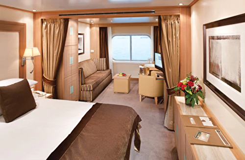
Located on Deck 4; Approximately 295 square feet (28 square meters) of inside space All Ocean View Suites feature: A large picture window Comfortable living area Queen-size bed or two twin beds Dining table for two Walk-in closet Interactive flat-screen television with music and movies. Fully stocked bar and refrigerator Makeup vanity Spacious bathroom with separate tub and shower

Approximately 295 square feet (28 square meters) of inside space For this option we select the location and specific suite for you, and notify you prior to departure. Guests are guaranteed to be assigned a suite in the category selected or higher. All Ocean View Suites feature a large picture window, comfortable living area, queen-size bed or two twin beds, dining table for two, walk-in closet, interactive flat-screen television with music and movies, fully stocked bar and refrigerator, makeup vanity, spacious bathroom with separate tub and shower.

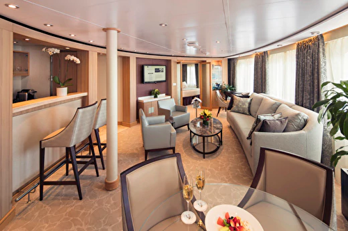
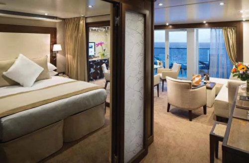
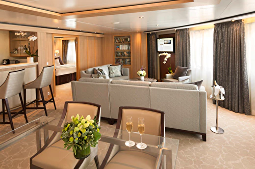
Approximately 1189 square feet (110 square meters) of inside space, plus two verandas totaling 214 square feet (20 square meters) Grand Wintergarden Suites feature Large windows Dining for six Glass-enclosed solarium with tub and day bed Two bedrooms Two bathrooms (one whirlpool) Guest bath Convertible sofa bed for one Pantry with wet bar Three flat-screen TVs Complimentary internet/Wi-Fi service
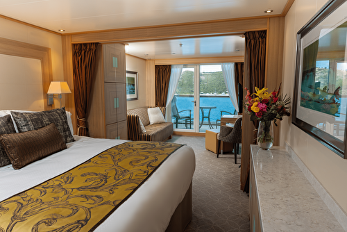
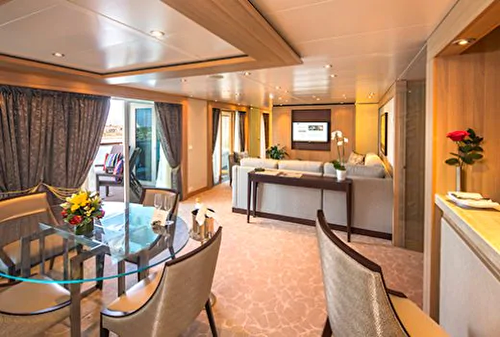
Approximately 526 & 593 square feet (49 to 55 square meters) of inside space, plus one veranda of 133 & 354 square feet (12 to 33 square meters) Owner's Suites feature: Expansive ocean views Forward-facing windows Dining for four to six Bathroom with whirlpool bathtub Guest bath Pantry with wet bar Two flat-screen TVs Complimentary Internet/Wi-Fi service

Approximately 526 & 593 square feet (49 to 55 square meters) of inside space, plus one veranda of 133 & 354 square feet (12 to 33 square meters) Owner's Suites feature: Expansive ocean views Forward-facing windows Dining for four to six Bathroom with whirlpool bathtub Guest bath Pantry with wet bar Two flat-screen TVs Complimentary Internet/Wi-Fi service
Penthouse Suite Approximately 436 square feet (41 square meters) of inside space, plus one veranda of 98 square feet (9 square meters) All Penthouse Suite feature: Dining table for two to four Separate bedroom Glass door to veranda Two flat-screen TVs Fully stocked bar Spacious bathroom with tub, shower and large vanity.
Penthouse Spa Suite Approximately 536 to 539 square feet (50 square meters) of inside space, plus one veranda of 167 to 200 square feet (16 to 19 square meters) All Penthouse Spa Suite feature: Dining table for two to four Separate bedroom Glass door to veranda Two flat-screen TVs Fully stocked bar Spacious bathroom with tub, shower and large vanity.

Veranda Suite Guarantee
Signature Suite Approximately 859 square feet (80 square meters) of inside space, plus one veranda of 493 square feet (46 square meters) Signature Suites feature: Expansive ocean views Forward-facing windows Dining for four to six Bathroom with whirlpool bathtub Guest bath Pantry with wet bar Two flat-screen TVs Complimentary Internet/Wi-Fi service

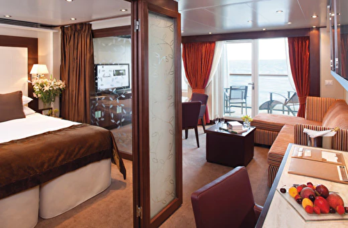
Located on Deck 5; Approximately 300 square feet (28 square meters) of inside space, plus one veranda of 65 square feet (6 square meters) All Veranda Suites feature: A full-length window and glass door to private veranda Comfortable living area Queen-size bed or two twin beds Dining table for two Walk-in closet Interactive flat-screen television with music and movies Fully stocked bar and refrigerator Makeup vanity Spacious bathroom with separate tub and shower.

Located on Deck 5; Approximately 300 square feet (28 square meters) of inside space, plus one veranda of 65 square feet (6 square meters) All Veranda Suites feature: A full-length window and glass door to private veranda Comfortable living area Queen-size bed or two twin beds Dining table for two Walk-in closet Interactive flat-screen television with music and movies Fully stocked bar and refrigerator Makeup vanity Spacious bathroom with separate tub and shower.
Located on Deck 6; Approximately 300 square feet (28 square meters) of inside space, plus one veranda of 65 square feet (6 square meters) All Veranda Suites feature: A full-length window and glass door to private veranda Comfortable living area Queen-size bed or two twin beds Dining table for two Walk-in closet Interactive flat-screen television with music and movies Fully stocked bar and refrigerator Makeup vanity Spacious bathroom with separate tub and shower.

Located on Deck 7; Approximately 300 square feet (28 square meters) of inside space, plus one veranda of 65 square feet (6 square meters) All Veranda Suites feature: A full-length window and glass door to private veranda Comfortable living area Queen-size bed or two twin beds Dining table for two Walk-in closet Interactive flat-screen television with music and movies Fully stocked bar and refrigerator Makeup vanity Spacious bathroom with separate tub and shower
Approximately 914 square feet (85 square meters) of inside space, one veranda of 183 sq. ft. (17 square meters.). Wintergarden Suites feature Large windows Dining for six Whirlpool bathtub Guest bath Convertible sofa bed for one Pantry with wet bar Glass-enclosed solarium with tub and day bed Two closets Two flat-screen TVs Complimentary Internet/Wi-Fi service
Seabourn Quest is the third iteration of the vessel design that has been called “a game-changer for the luxury segment.” True to her Seabourn bloodlines, wherever she sails around the world, Seabourn Quest carries with her a bevy of award-winning dining venues that are comparable to the finest restaurants to be found anywhere. Seabourn Quest offers a variety of dining options to suit every taste and every mood, with never an extra charge.
Located on Deck 4; Approximately 295 square feet (28 square meters) of inside space All Ocean View Suites feature: A large picture window Comfortable living area Queen-size bed or two twin beds Dining table for two Walk-in closet Interactive flat-screen television with music and movies. Fully stocked bar and refrigerator Makeup vanity Spacious bathroom with separate tub and shower
Approximately 295 square feet (28 square meters) of inside space For this option we select the location and specific suite for you, and notify you prior to departure. Guests are guaranteed to be assigned a suite in the category selected or higher. All Ocean View Suites feature a large picture window, comfortable living area, queen-size bed or two twin beds, dining table for two, walk-in closet, interactive flat-screen television with music and movies, fully stocked bar and refrigerator, makeup vanity, spacious bathroom with separate tub and shower.
Approximately 1189 square feet (110 square meters) of inside space, plus two verandas totaling 214 square feet (20 square meters) Grand Wintergarden Suites feature Large windows Dining for six Glass-enclosed solarium with tub and day bed Two bedrooms Two bathrooms (one whirlpool) Guest bath Convertible sofa bed for one Pantry with wet bar Three flat-screen TVs Complimentary internet/Wi-Fi service
Approximately 526 & 593 square feet (49 to 55 square meters) of inside space, plus one veranda of 133 & 354 square feet (12 to 33 square meters) Owner's Suites feature: Expansive ocean views Forward-facing windows Dining for four to six Bathroom with whirlpool bathtub Guest bath Pantry with wet bar Two flat-screen TVs Complimentary Internet/Wi-Fi service
Approximately 526 & 593 square feet (49 to 55 square meters) of inside space, plus one veranda of 133 & 354 square feet (12 to 33 square meters) Owner's Suites feature: Expansive ocean views Forward-facing windows Dining for four to six Bathroom with whirlpool bathtub Guest bath Pantry with wet bar Two flat-screen TVs Complimentary Internet/Wi-Fi service
Penthouse Suite Approximately 436 square feet (41 square meters) of inside space, plus one veranda of 98 square feet (9 square meters) All Penthouse Suite feature: Dining table for two to four Separate bedroom Glass door to veranda Two flat-screen TVs Fully stocked bar Spacious bathroom with tub, shower and large vanity.
Penthouse Spa Suite Approximately 536 to 539 square feet (50 square meters) of inside space, plus one veranda of 167 to 200 square feet (16 to 19 square meters) All Penthouse Spa Suite feature: Dining table for two to four Separate bedroom Glass door to veranda Two flat-screen TVs Fully stocked bar Spacious bathroom with tub, shower and large vanity.
Veranda Suite Guarantee
Signature Suite Approximately 859 square feet (80 square meters) of inside space, plus one veranda of 493 square feet (46 square meters) Signature Suites feature: Expansive ocean views Forward-facing windows Dining for four to six Bathroom with whirlpool bathtub Guest bath Pantry with wet bar Two flat-screen TVs Complimentary Internet/Wi-Fi service
Located on Deck 5; Approximately 300 square feet (28 square meters) of inside space, plus one veranda of 65 square feet (6 square meters) All Veranda Suites feature: A full-length window and glass door to private veranda Comfortable living area Queen-size bed or two twin beds Dining table for two Walk-in closet Interactive flat-screen television with music and movies Fully stocked bar and refrigerator Makeup vanity Spacious bathroom with separate tub and shower.
Located on Deck 5; Approximately 300 square feet (28 square meters) of inside space, plus one veranda of 65 square feet (6 square meters) All Veranda Suites feature: A full-length window and glass door to private veranda Comfortable living area Queen-size bed or two twin beds Dining table for two Walk-in closet Interactive flat-screen television with music and movies Fully stocked bar and refrigerator Makeup vanity Spacious bathroom with separate tub and shower.
Located on Deck 6; Approximately 300 square feet (28 square meters) of inside space, plus one veranda of 65 square feet (6 square meters) All Veranda Suites feature: A full-length window and glass door to private veranda Comfortable living area Queen-size bed or two twin beds Dining table for two Walk-in closet Interactive flat-screen television with music and movies Fully stocked bar and refrigerator Makeup vanity Spacious bathroom with separate tub and shower.
Located on Deck 7; Approximately 300 square feet (28 square meters) of inside space, plus one veranda of 65 square feet (6 square meters) All Veranda Suites feature: A full-length window and glass door to private veranda Comfortable living area Queen-size bed or two twin beds Dining table for two Walk-in closet Interactive flat-screen television with music and movies Fully stocked bar and refrigerator Makeup vanity Spacious bathroom with separate tub and shower
Approximately 914 square feet (85 square meters) of inside space, one veranda of 183 sq. ft. (17 square meters.). Wintergarden Suites feature Large windows Dining for six Whirlpool bathtub Guest bath Convertible sofa bed for one Pantry with wet bar Glass-enclosed solarium with tub and day bed Two closets Two flat-screen TVs Complimentary Internet/Wi-Fi service
Included Services
Golf Leaf service included on Rocky Mountaineer
Pre cruise and train Transfers
Hotel Stays in Banff, Kamloops and Vancouver
Luxury Cruise onboard Seabourn for 14 nights.
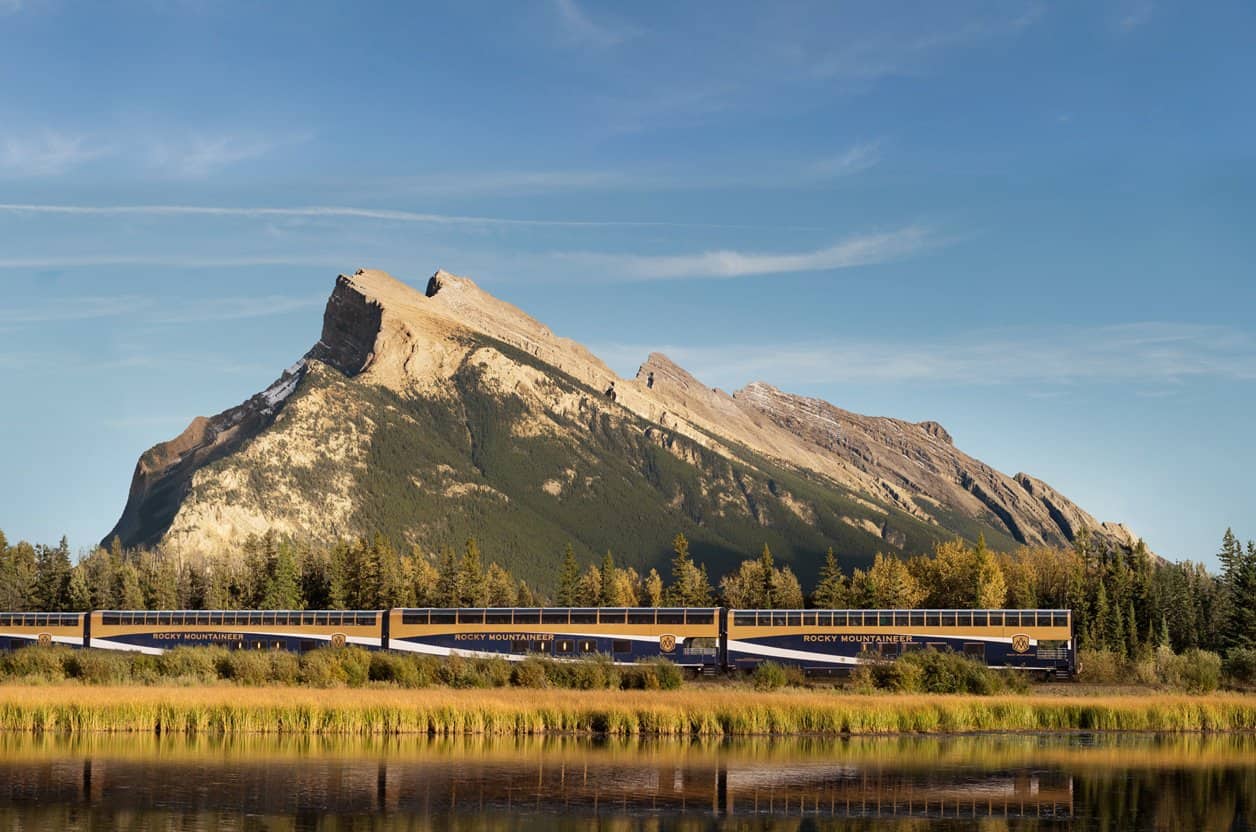
2 days train included onboard the Rocky Mountaineer from Banff to Vancouver. Gold Leaf Service.

Transfers included from Train to Hotels and to the Port.
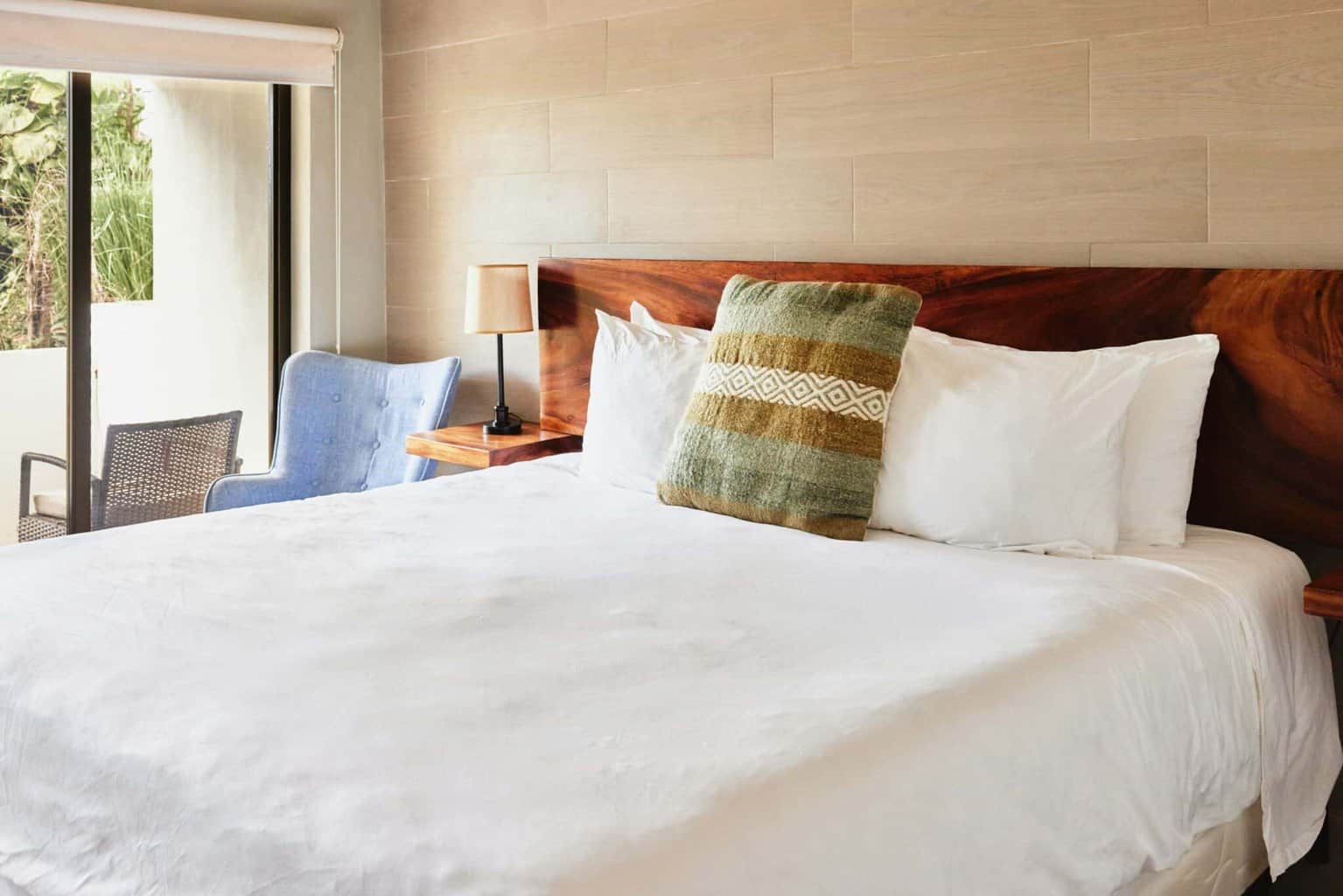
1 night pre stay in Banff, 1 night in Kamloops and 1 night in Vancouver.